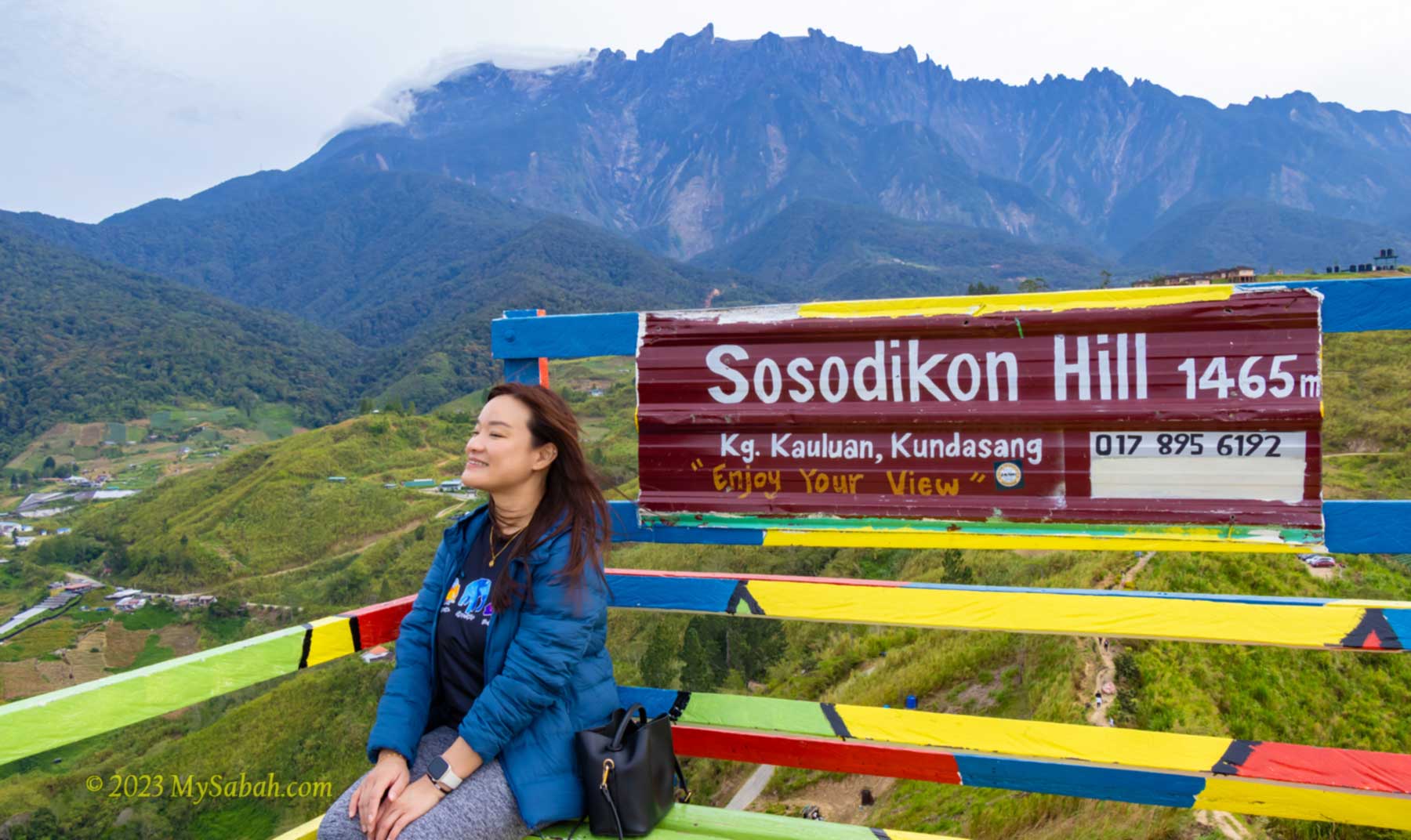
In only 10 minutes, you can conquer a peak that is higher than the highest mountain of Johor, Penang, Melaka, Negeri Sembilan, and Perlis States. I’m talking about Sosodikon Hill in Kundasang of Sabah, Malaysia. Anyway, most people climb Sosodikon Hill for the rewarding view, not the height.
At an elevation of about 1,300 Metres (4,265 ft), Kundasang is the highest town of Malaysia. Kundasang is also the closest town to Mount Kinabalu, the highest mountain of Malaysia, and only 6 kilometres away from Kinabalu National Park, the second UNESCO Global Geopark of Malaysia. Coupled with cooling weather, this highland town is a popular vacation spot for local and foreign tourists.
The altitude of Sosodikon Hill is 1,465 Metres (4,806 ft) above sea level. Sound really tall right? Actually, if measured from its foothill, Sosodikon Hill is only about 70 Metres (230 ft) tall. Nevertheless, its peak allows you to have a panoramic view of Mount Kinabalu and Kundasang Valley.
Some local Chinese like to make fun of the name “Sosodikon” because it sounds like “傻傻地看” (means staring foolishly) in Hakka dialect (no offense). Actually Sosodikon means “a place for laying traps” in Dusun language. When Sosodikon Hill was covered by thick forest in the past, the villagers frequently set traps there to hunt for wildlife such as deer and birds.
Is Sosodikon Hill worth a visit? Yes, if you love to take some beautiful photos of Mount Kinabalu and Kundasang Valley. You can frame a lot of things in the photos taken from the highest point of Kundasang. After all, the hike is so easy and take less than 15 minutes.
However, you are advised to reach the peak before 8am, the time Mount Kinabalu is still visible. In most days, Mount Kinabalu would be covered by dense cloud after 9am. If it’s misty or raining, climbing Sosodikon Hill may not worth your time.
Sosodikon Hill (see Location Map) is about 98 Kilometres from Kota Kinabalu City and quite accessible. If you plan to visit DESA dairy farm, you may include Sosodikon Hill in your itinerary as both places are near to each other. The road to the starting point is mainly paved road in ok condition. The last 800 Metres away from the main road to the starting point is a narrow cement and gravel road (no 4WD required).
There are some parking spaces for cars within walking distance to the ticket booth, which is open from 6am to 5pm every day. You will be given a pass card after you pay the entrance fee, then you can start climbing the hill. No guide is required. The following is the entrance fee per person in Malaysian Ringgit:
- Malaysian Adult (13 years old and above): RM5.00
- Malaysian Child (7-12 years old): RM3.00
- Foreigner Adult: RM10.00
- Foreigner Child: RM5.00
- Free admission for children 6 years old and below
Walk-in tourist is welcomed and no advance booking is needed. You may use the small toilet next to the booth before or after the hike.
The 300-metre trail to the peak is a well trodden soil path. As the trail isn’t very steep, you can walk up, without much climbing, to reach the peak between 10 to 15 minutes. Though it’s an easy short hike, you may walk slowly to enjoy the view. They planted some flowers and installed some decorations along the way.
The view of Mount Kinabalu was so breathtaking that I kept stopping to take some photos. The view got nicer and nicer when I was moving up. The weather was cooling and the morning sunlight was soft. This hill is mainly grassy slope with very few trees that offer shade, so you better apply sunscreen if you climb in the afternoon. It’s quite windy on top so please put on a jacket for a more comfortable walk.
The ending point is a colourful wooden platform with boardwalk on the highest point, where you can have a 360° view of Kundasang Valley under the majestic Mount Kinabalu.
Besides Mount Kinabalu, the rolling Pyramid Hills at another side is scenic as well. Pyramid Hills is an example of triangular facets (or faceted spur), a geomorphic feature produced by active fault movements that started 15 million years ago from the ongoing collision in Sabah. Stream erosion passing through the fault scarps create the triangular-shaped cliff face.
Unfortunately, some farmland has creeped into the foothill of Pyramid Hills. I hope the locals will spare these green hills from agriculture and development. In fact, due to land clearing, the temperature of Kundasang has risen to 18 to 30 Celsius now, compared to 10-18 Celsius before 1990. People should learn not to repeat the bad consequences that happen to the overdeveloped Cameron Highlands in Peninsular Malaysia.
Below are some channels for you to contact or follow the operator of Sosodikon Hill:
Phone (Whatsapp): +60 17-8956192
E-mail: sosodikonhill@gmail.com
Website: sosodikonhill.com
Instagram: sosodikonhill
Facebook: sosodikonhillkundasang
Photos taken in Kundasang, Sabah, Malaysia Borneo
