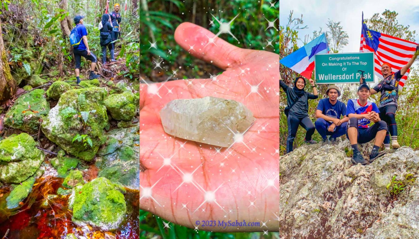
Imagine you are an adventurer in a role-playing game and given a quest that says, “Find the magic crystals on an extinct volcano mountain, where you will traverse through a dwarf forest with blood-red rivers, mossy rocks and flesh-eating plants.” This scene matches Mount Wullersdorf perfectly. Time for me to walk out of my virtual world and steps into the uncharted territory in Mount Wullersdorf as a real adventurer.
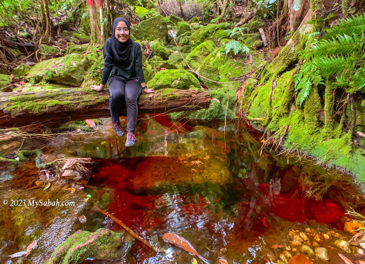
In terms of geology and vegetation, Mount Wullersdorf is special because it is:-
- An extinct volcano, a geological heritage of Sabah
- Heath forest with red river and rare plants
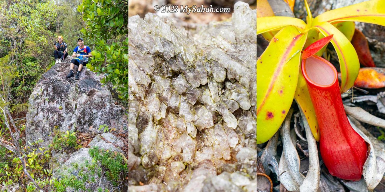
- A world of natural crystals in Sabah
Itinerary
The following is the itinerary of climbing Mount Wullersdorf. It is a day trip with a hiking distance of 7 kilometres. You must book the tour in advance.
7:30am Gather at Dewan Kampung Balung Cocos (Tawau)
8:00am Depart to the Control Post (Sabah Forestry Department) of Wullersdorf, the starting point of the climb
8:30am Start climbing after registration and briefing
9:30am-10:00am Reach the first peak after 30-40 min (2 km)
11:00am-12:00pm Reach the second peak (Wullersdorf Peak) after 4 km. Rest and lunch on summit
1:00pm Hike back to the Control Post via shortcut (1 km for 40 min)
2:30pm End of tour
Walk-through
Are you ready for the epic quest adventurer? Or you can watch the 6-minute video below:
The height of Mount Wullersdorf is 430 metres (1,411 ft) above sea level. The one-way distance to the highest peak is 6 kilometres, which takes about 3 to 4 hours. There is a 1-kilometre shortcut from the peak back to the starting point, so in total it’s a 7-km loop trail.
Going to the Starting Point
Mount Wullersdorf is located in a Class-1 (fully protected) forest in Kunak (Tawau Division). To enter the mountain, you need a permit from the Sabah Forestry Department. So I get a local agent who can get the permit and arrange the climbing trip for me. Just a few messages back and forth with the agent and I get the booking done. Easy.

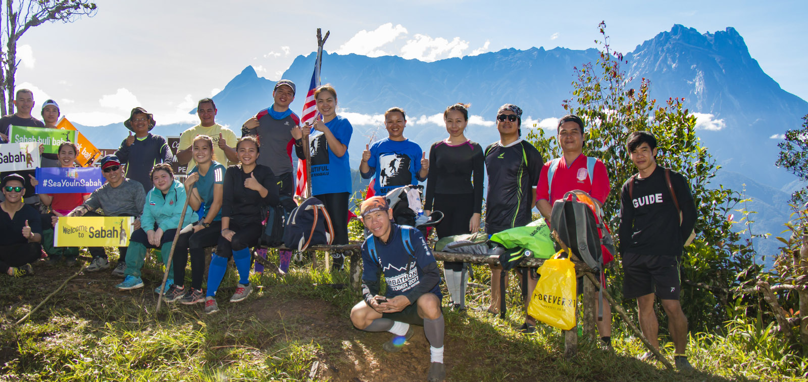
I meet my guides at Dewan Balung Cocos (Balung Cocos Village Community Hall) around 7:30am. Mr. Eady and Pakri are my guides, who live in this village. Also joining me are Mr. Aidil and Ms Zura, the hikers from Tawau. It’s drizzling in the morning. I’m concern about the gloomy weather but Pakri says that the red river is more beautiful when it has more water.

We hop on our pick-up truck to depart to the starting point of the climb. It’s a bumpy ride on a gravel road in an oil palm plantation. After 10 to 15 minutes, we reach the control post of Sabah Forestry Department. Besides us, there is team of 20 members from Lahad Datu Hash House guided by another agent, Uncle Mul.
About Wullersdorf
Mount Wullersdorf is part of Mount Wullersdorf Forest Reserve, which is 8,137 hectares in size. It’s linked with five other adjacent forest reserves to form a 64,953.74 Ha of Ulu Kalumpang-Wullersdorf Sustainable Forest Management (SFM) Project. The Class-1 Ulu Kalumpang Forest Reserve which covers an area of 50,736 hectares is the biggest forest reserve under this project. This SFM Project is certified by the Forest Stewardship Council® (FSC) as a well-managed forest.
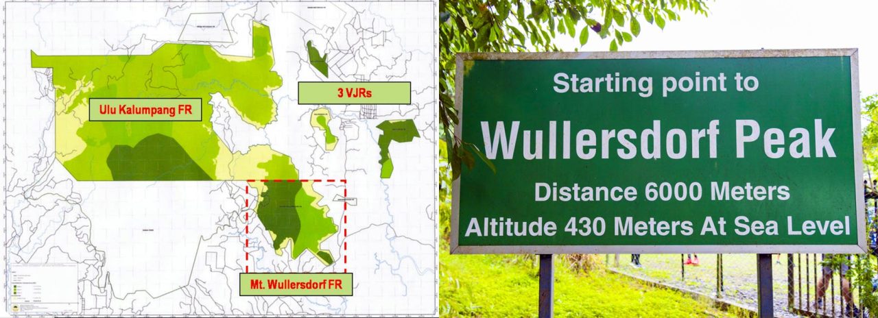
These forest reserves are also the habitat of threatened animals in Borneo such as orangutan, Bornean Pygmy Elephant, Bornean Sun Bear and Bornean Gibbon. Iconic birds like hornbills and Crested Fireback also nest there. Under good conservation, the mountains also protect the headwaters and water catchment areas that are source of water for Tawau and Kunak Districts. The rangers there also mention the sighting of a golden rat (I assume it’s a Malayan weasel or Yellow Throated Marten), and the tracks of a baby Sumatran rhino many years ago. Sadly this rhino species is declared extinct in the wild in Malaysia in 2015.
0 to 2 KM
After registration and briefing, we start to hike at 8:30am. FYI, you can use the toilet at the control post before and after the climb. The first 250 metres is a walk on flat ground covered with tall grasses and shrubs. About 10 minutes later we reach a manmade pond, which marks the start of the loop trail at foothill.
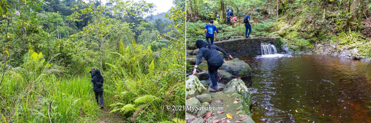
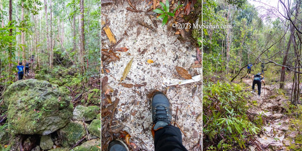
The trees are tall in the beginning and their dense canopy blocks the rain. I see a green path ahead. It’s a rugged riverbed trail littered with green mossy rocks, with red-colored stream flowing between them. The red water and green rock form a very striking contrast, the scenery is out of this world. No wonder they call it the “Lost World of Balung“.
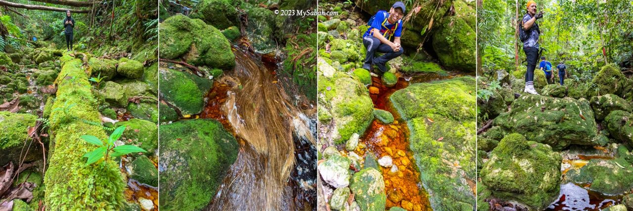
We climb up and down on these mossy rocks to ascend. Some of the rocks are slippery. It will help a lot if your hiking shoes have good grip, because most of the time we walk on river rocks. Overall, the trail is not really steep, but climbing hundred of rocks will slow you down. I’m the slowest one as I’m already too busy taking pictures in the first two kilometres.
Red River (Local Name: Sungai Merah)
This side of Mount Wullersdorf is dominated by heath forest, which grows on sandy soil with poor nutrients. With infertile environment, plants in heath forest are usually rich in tannins as a defense, which make them toxic or indigestible to plant eaters.
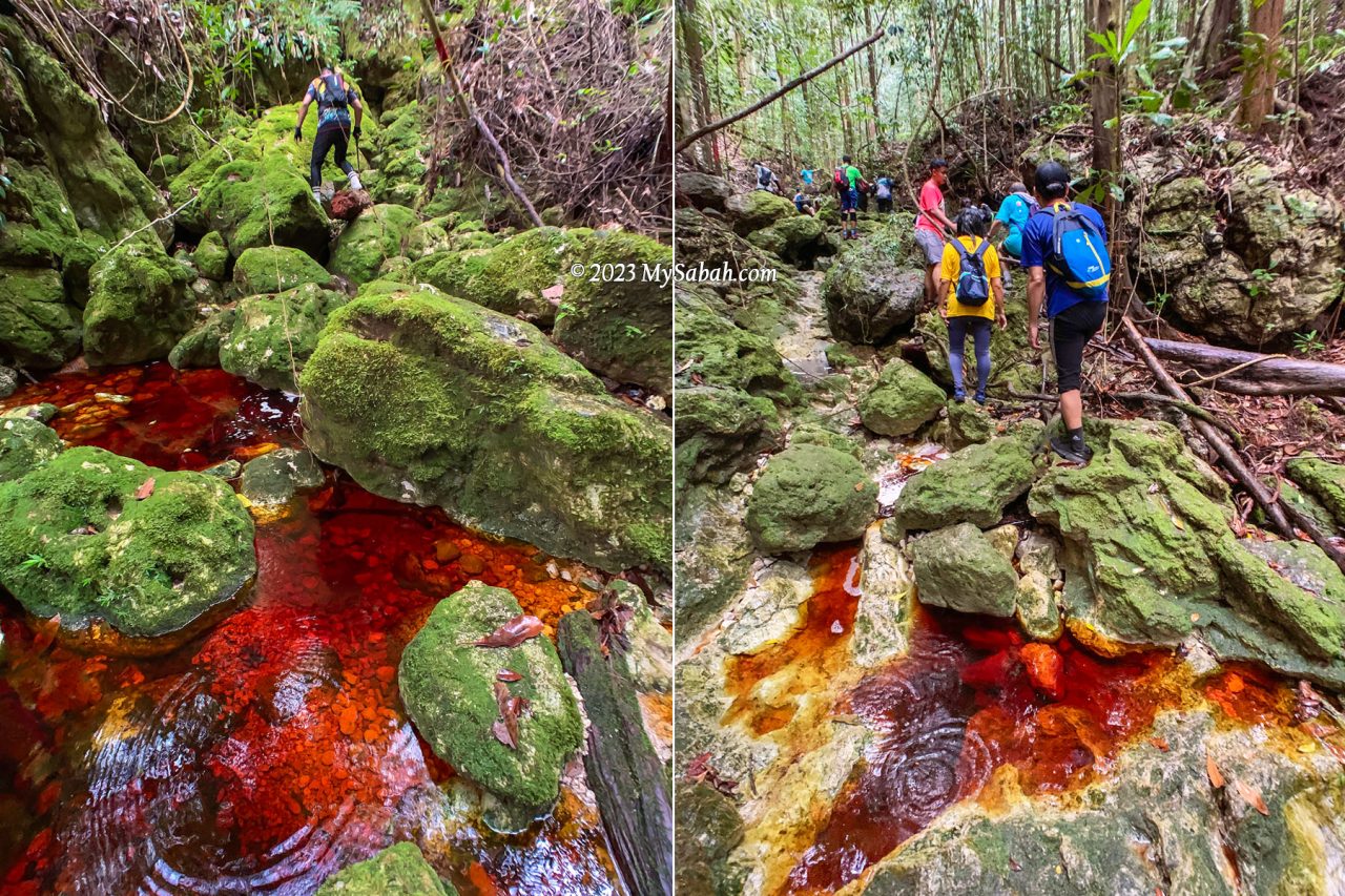
However, tannin is hard to break down. When water drains through thick dead leaves and debris that cover the forest floor, the tannins and humic acids leach through the porous sandy substrate, finding their way into streams, and dye the water with brownish tea color.
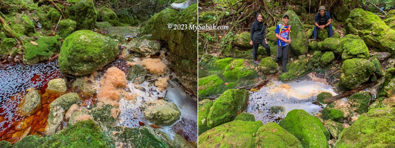
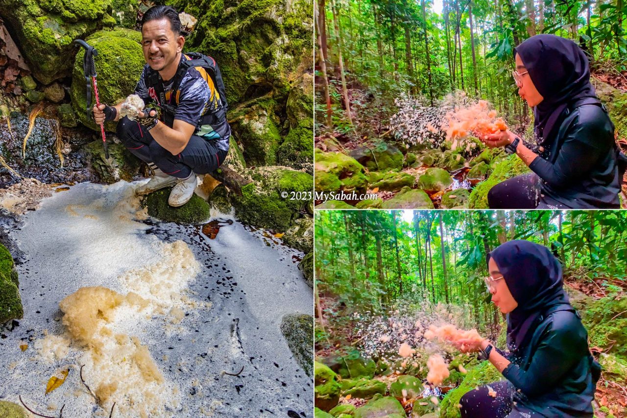
Such tea-colored water is also well-known for its foaming nature, probably due to the saponin and humic composition originated from the peat of heath forest. The water is a bit acidic but safe to drink after boiling.
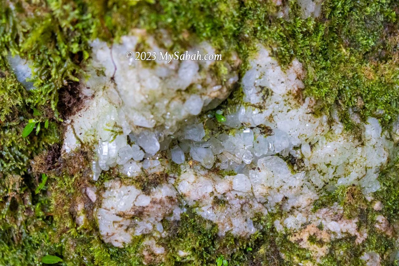
We are excited to see a few river rocks that have cracks with crystals inside them. The guides say there are more crystals on Wullersdorf Peak.
First Peak
There are two peaks to conquer in our climb. The first peak is only 2 km away. When the peak is getting near, we move away from the river trail and walk up a slope with mild steepness. I notice there are some whitish volcanic rocks on the higher ground. We arrive the first peak at 10am.
An Ancient Volcano
Mount Wullersdorf is an extinct volcano. Such volcanic landscape is only found in Southeastern part of Sabah, where volcanic eruption occurred between 1 to 9 million years ago. Even today we can find the remnants of volcanism in Sabah such as Columnar Basalt at Balung River (Tawau) and Bohey Dulang Island in Semporna.
From Miocene to late Pleistocene, a series of volcanisms creates the major mountainous backbone of the Tawau mountains, which include Mount Wullersdorf, Mount Maria, and Bombalai Hill. The earlier volcanic rocks of andesitic and dacitic composition formed a line of composite volcanoes from Mount Magdalena to Mount Wullersdorf and Mount Pock at Semporna District.
Most climbers wouldn’t realise that Mount Wullersdorf is an extinct volcano since most of the traces and features of volcanism are covered up by dense forest nowadays. I wonder how many people know there are at least 10 extinct volcanoes in Tawau.
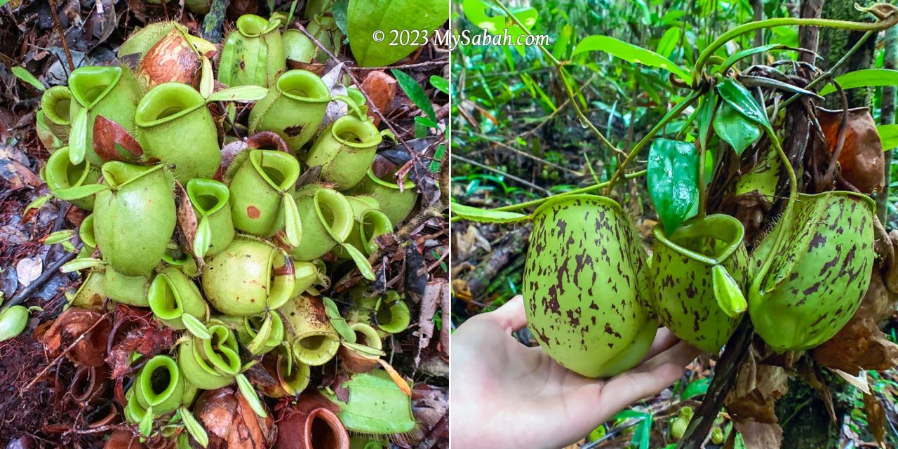
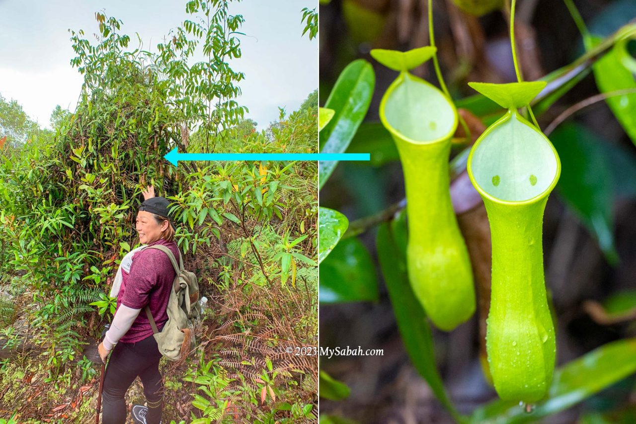
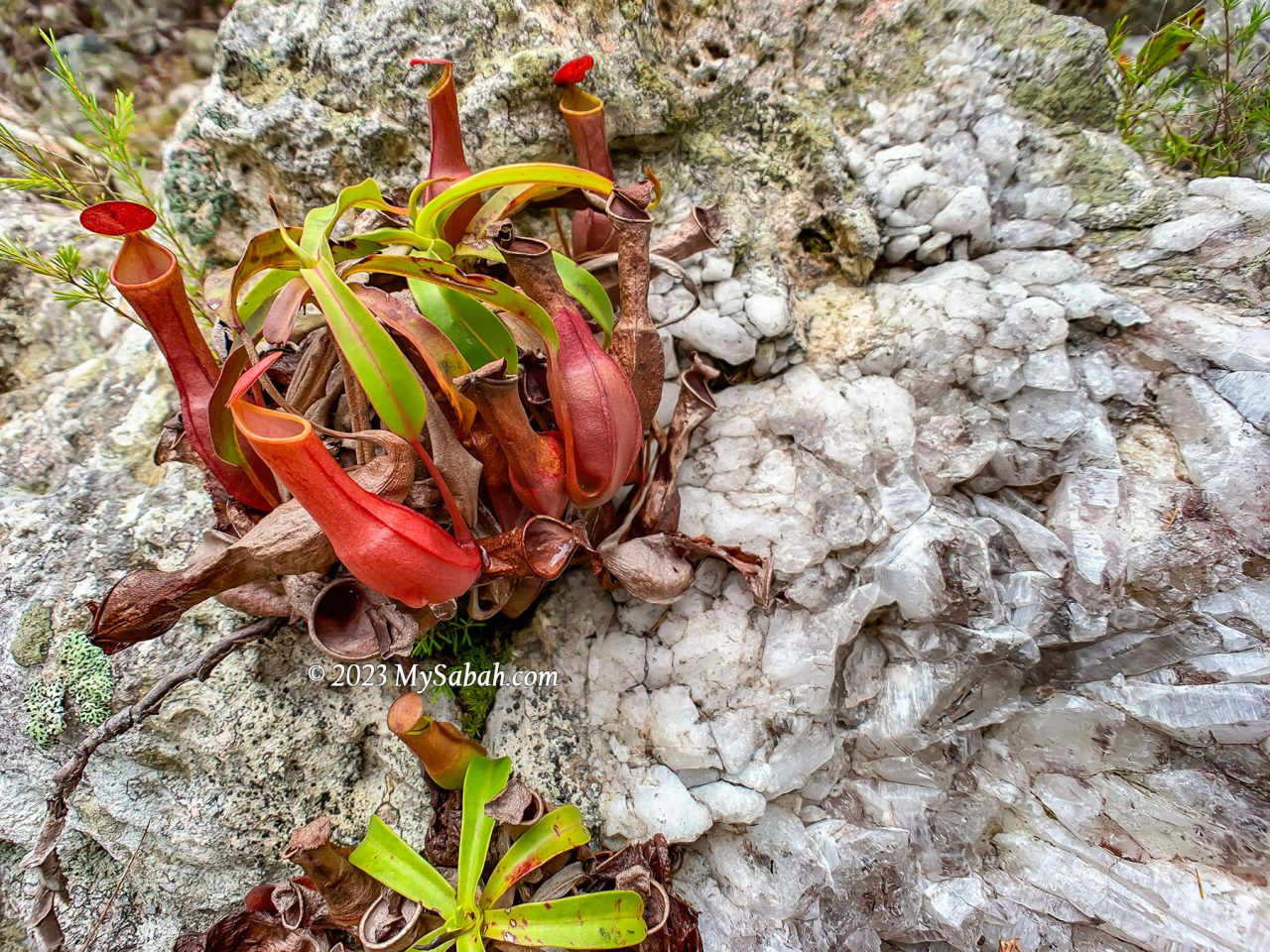
Anyway, it’s easy to spot many pitcher plants around the first peak. Nepenthes ampullaria likes to grow in damp area under trees, where it can collect leaf debris as food with its wide open mouth. Nepenthes reinwardtiana (green variant) is another common pitcher plant on this mountain.
2rd to 6th KM
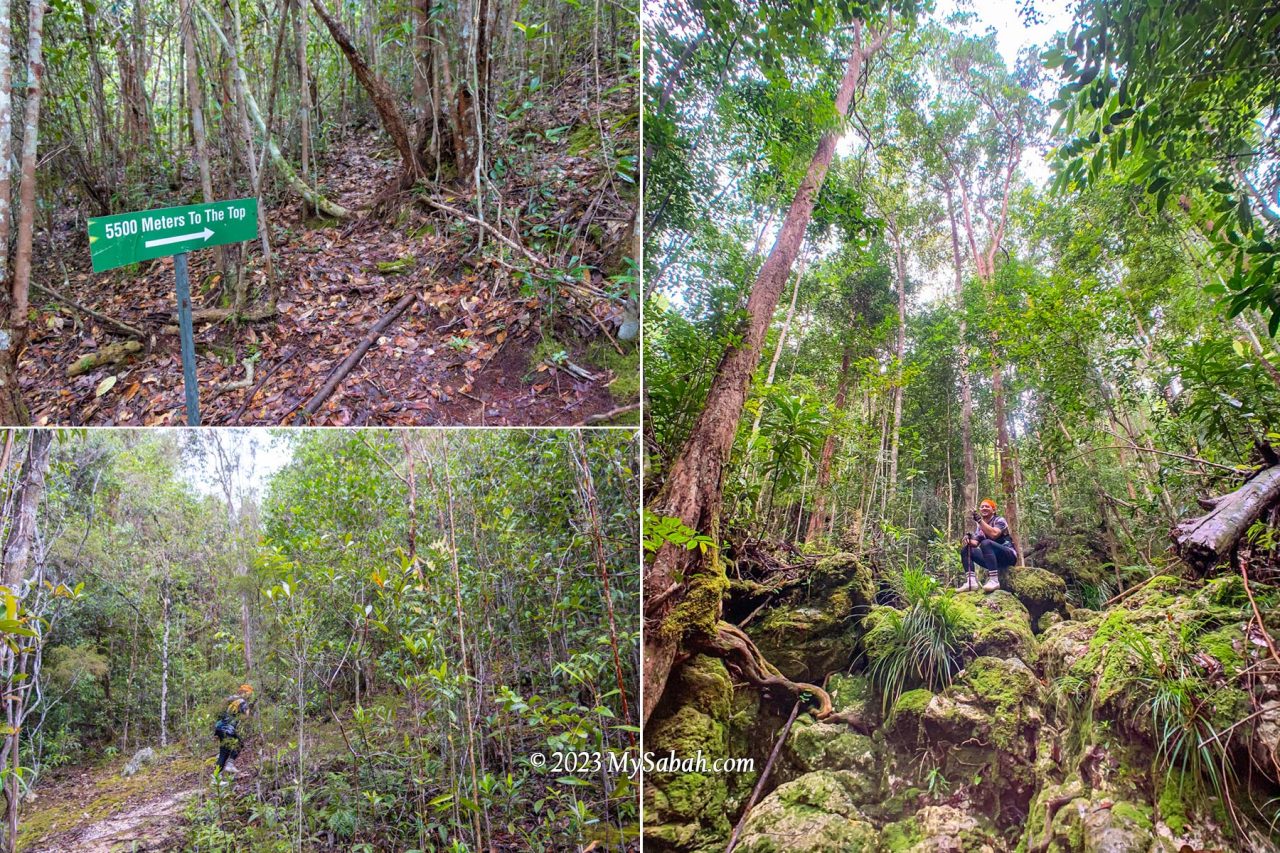
After a short break on the first peak we proceed to the second peak about 4 km away. The trail between the first and second peak is mainly jungle trail with more even surface, which I enjoy more. The peak area is heath forest, a forest type that covers only 2 to 3% of Borneo island, the home to the largest heath forests in Southeast Asia.

Heath Forest (Kerangas)
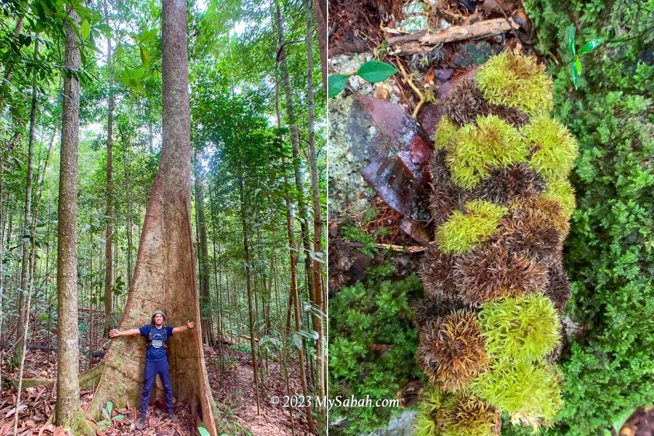
In contrast to the typical Borneo rainforest with towering trees, heath forests are characterized by shorter, pole-sized trees that are mostly lower than 20 metres with a stem diameter of 10-20 cm. The short-statured trees are a result of inherently infertile, acidic, white sandy soils.
The Iban people of Sarawak call heath forests as “Kerangas”, which means “forest with underlying soils that cannot grow rice”. Only specialized plants can survive such soils with poor nutrients. Though the plant diversity of heath forest is lower than rainforest, it has higher numbers of rare and endemic tree species with high conservation value.
Borneo has the widest variety of heath forest in Asia. Lowland heath forests (below 1,000 metres above sea level) like Wullersdorf are found inland on sandstone plateaus and cuesta formations on the hillsides.
The surrounding is lit because the small-crowned trees there don’t obstruct much sunlight. The higher the ground, the smaller the trees, to almost shrub-like. We walk in dense thickets of tidy straight bole stem trees with stunted appearance. The forest floor is criss-crossed by tangled roots, making the ground soft to walk on.
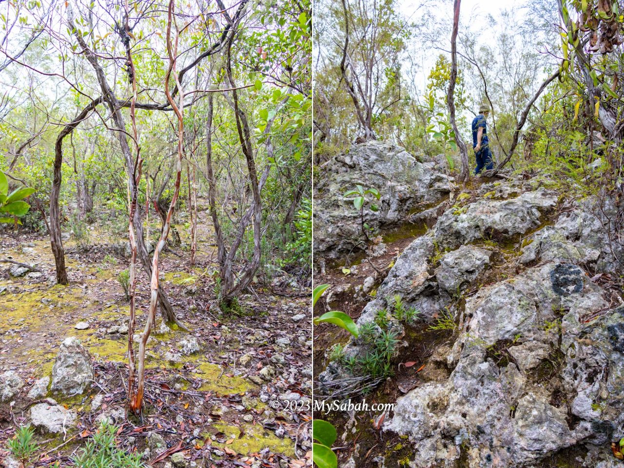
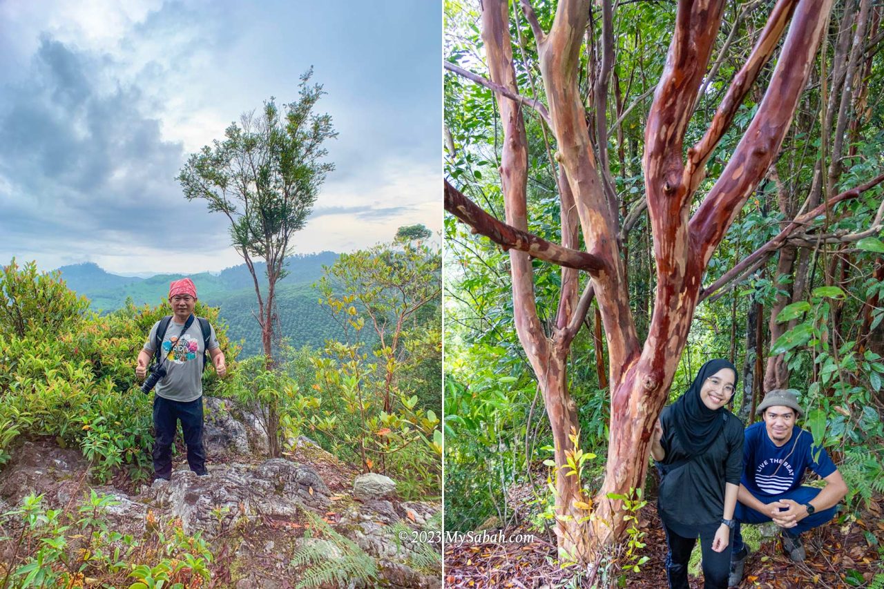
One of the special trees we see is Tristaniopsis trees, easy to identify by its orange-brown, smooth and shiny trunk, with scrolls of bark that spontaneously peel-off, hanging as untidy bunches along the trunk and forming a heap at the base of the tree. The forest is quiet. We hear a few hornbills flying over the canopy.
Wullersdorf Peak (Height: 430 Metres)
As we are approaching the second peak, the trees getting sparse, more sandy soil is exposed and the ground is more rocky. Finally we reach Wullersdorf Peak by noon. It’s a rocky peak surrounded by loud cicada calls and greyish volcanic rocks.
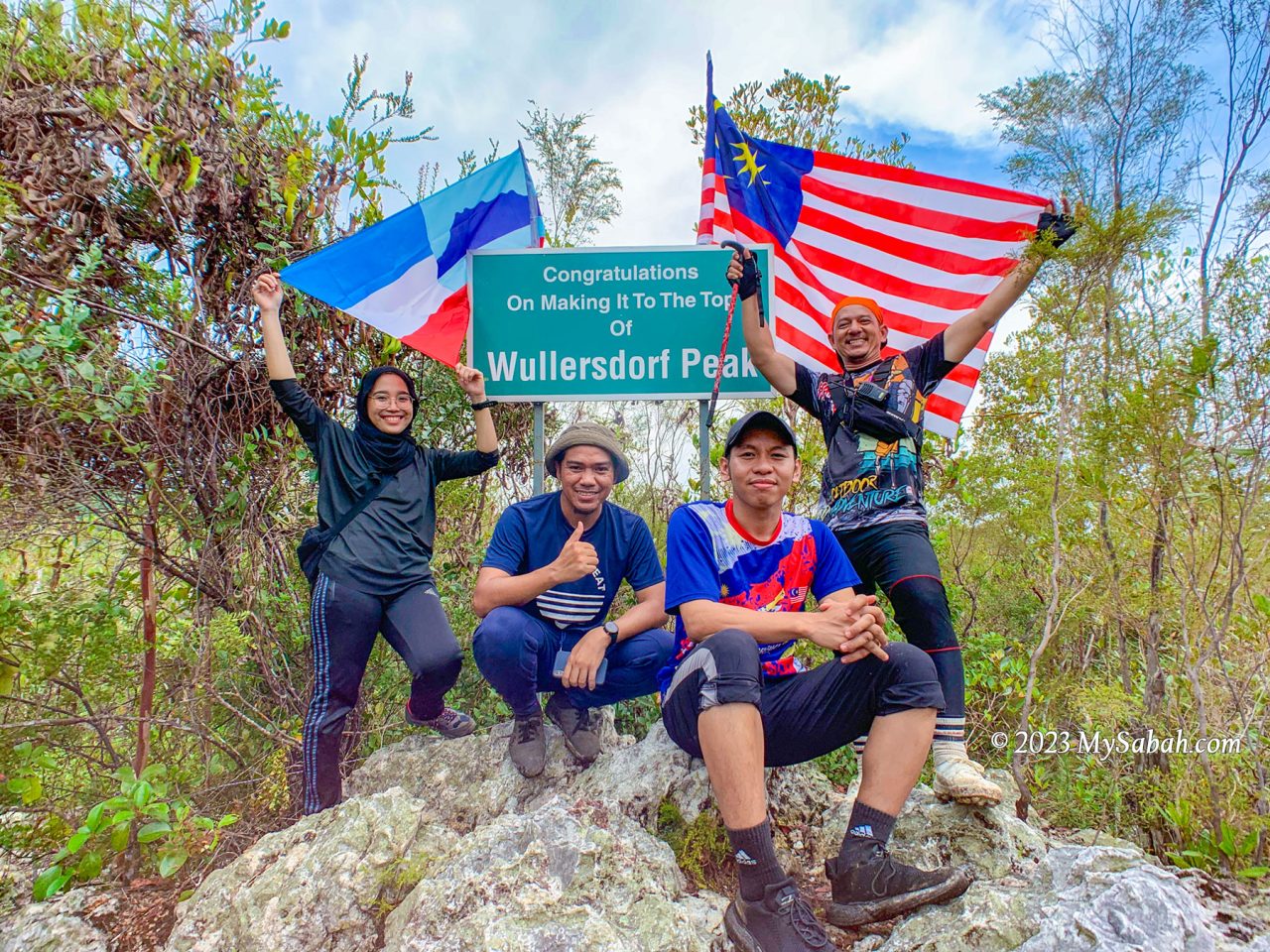
We spend on summit to have our lunch. I decide to explore around the peak as the understory of heath forest is often filled with remarkable plant species.
Pitcher Plant and Ant Plant
Forests thrive on two primary nutrients: nitrogen and phosphorus, what the kerangas is lack of. Under nutrient-deficient environment, carnivorous pitcher plants survive by trapping and digesting insects for additional nutrition.
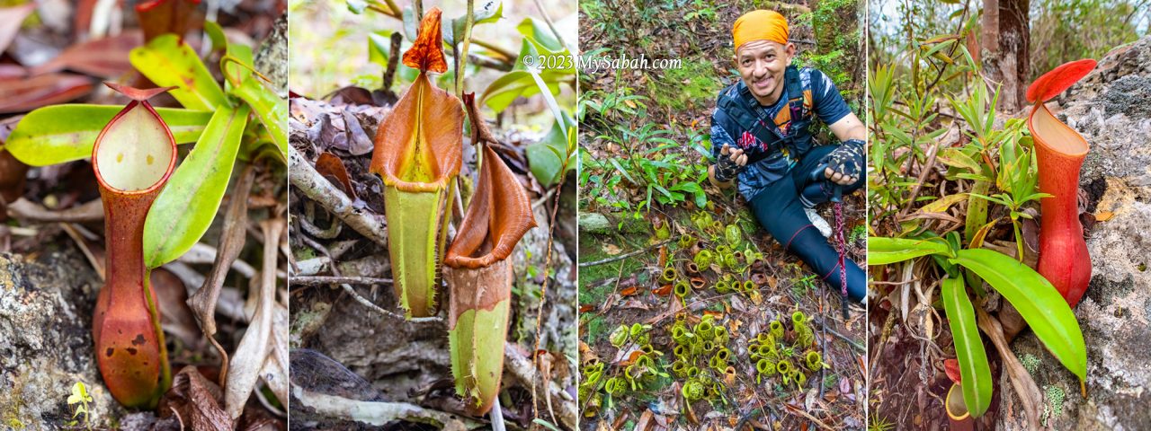
Uncle Mul told me that there are seven species of pitcher plant in Wullersdorf. I found Nepenthes ampullaria, Nepenthes reinwardtiana (red and green variants) and Nepenthes veitchii (endemic to Borneo).
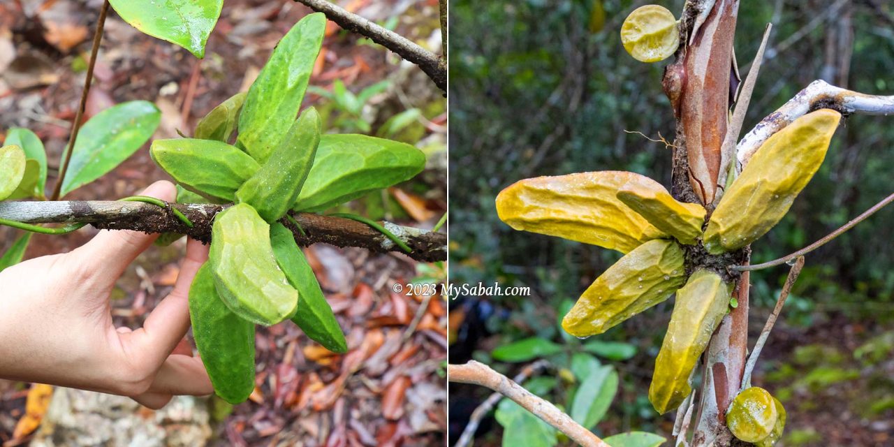
Instead of preying on insects, ant-plants choose to work with insects and build a symbiotic relationship with ants. I find a few green and yellow epiphytic ant-plants (Dischidia major) twine around the branches of trees. These ant-plants possess pouch-like modified leaves with hollow inside that acts as a shelter for ants. In exchange for the accommodation, the ants provide the plants with nitrogen-rich debris and feces.
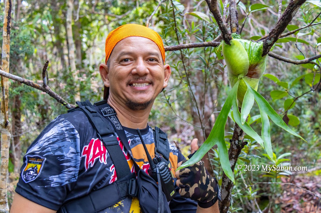
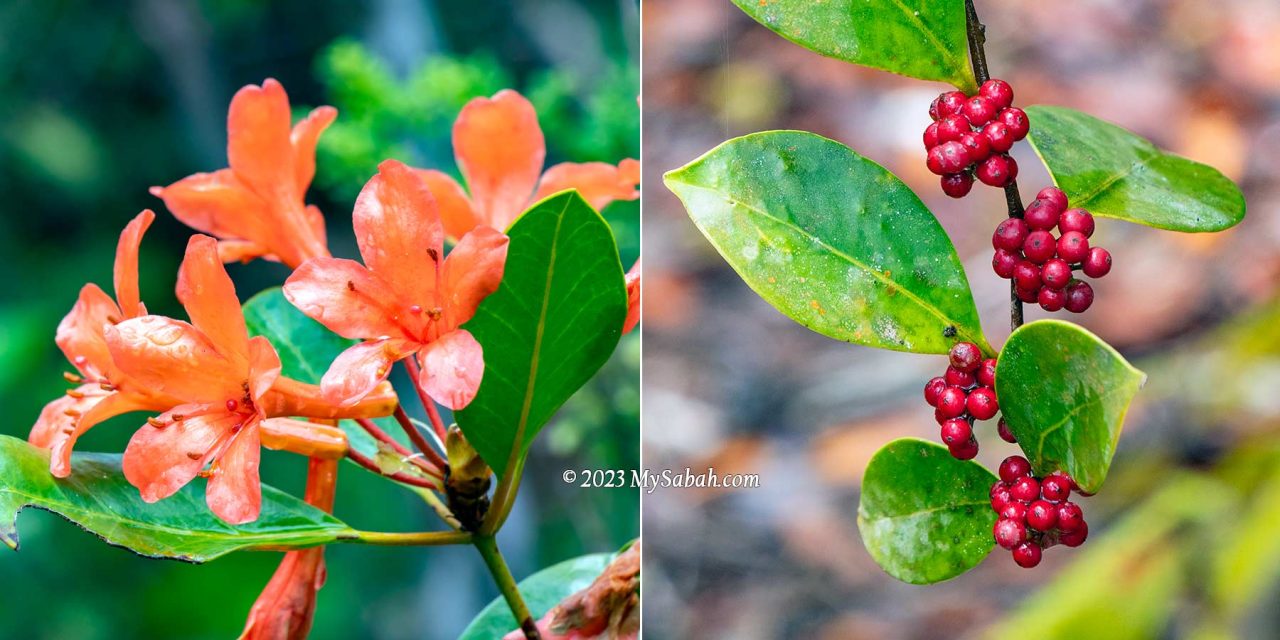
Wild staghorn ferns and rhododendron flowers are my other favourite sighting in this kerangas garden. I’m sure there are more to see if I stay longer.
Crystals and Gold of Wullersdorf
The most fascinating feature of Wullersdorf are the crystal rocks, which are abundant on the peak. Quite a number of rocks there are embedded with translucent white and pinkish crystals of different shapes and sizes. I also find many crystal fragments on the ground. I never see anything like this in other places of Sabah.
Some believe that crystals have healing powers and able to boost your mood. I don’t know if it’s true. But if you give me crystals, I’ll be in good mood. Don’t worry. I only photograph them and didn’t take any.
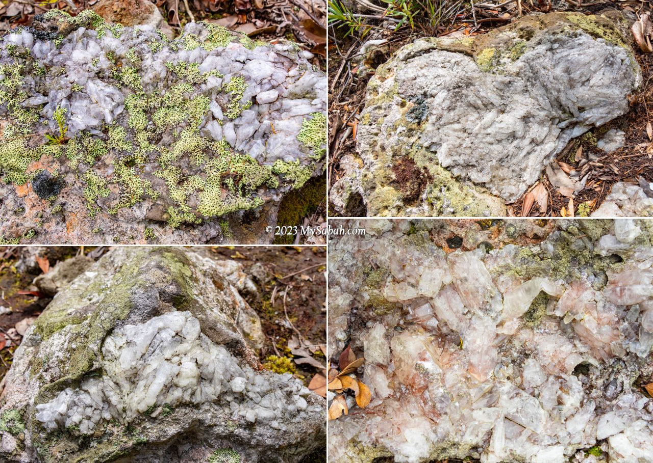
In nature, crystal can form when magma cools and hardens. This glittering beauty is another evidence that proves Mount Wullersdorf was used to be a volcano. Scientists say volcanic crystals is a time capsule of eruption history. Hope we will learn more about this geotourism destination from its crystals.
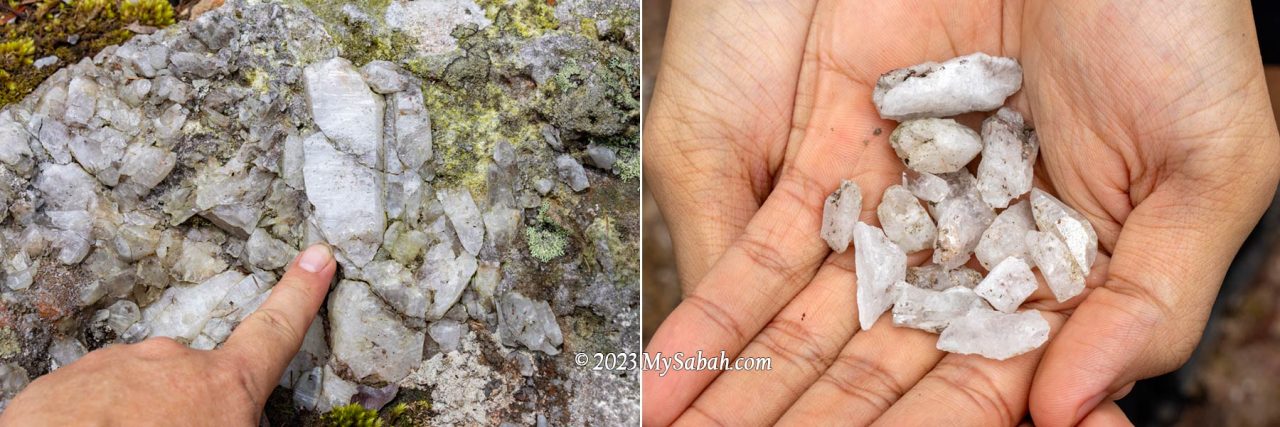
Wait, Wullersdorf has another fabulous mineral, GOLD. It’s estimated that about 30 tons of gold and 19 tons of silver are buried under a parcel of land about 948 hectares in the Mount Wullersdorf area. Well, we better don’t create another disaster like Mamut copper mine.
Return to Starting Point
After taking zillion of photos, I leave Wullersdorf Peak reluctantly. It’s a relief that we don’t need to turn back to the starting point using the same 6-km trail. We use the 1-kilometre shortcut to return to the starting point.
The descending trail takes about 40 minutes and it is the steepest part of the climb. Luckily there are some rope support for us to move down safely because part of the trail is quite slippery. We arrive foothill before 2pm as planned. I would say Wullersdorf Peak is one of the best hiking trails in Sabah. FYI, after the climb many hikers take a dip at the river of Batu Bersusun, the only Columnar Basalt in Malaysia, which is only 5 minutes away from Dewan Balung Cocos.
Is Mount Wullersdorf Hard to Climb?
The climbing trail to Wullersdorf Peak is not too steep and difficult, even for beginners. If you do workout regularly, it’s fairly easy. To experienced hikers, it’s just a long hike. The main challenge is to climb over the slippery rocks about half of the time. Wearing a good pair of hiking shoes can make a huge difference. It’s a bonus if the shoes are waterproof too, though you won’t walk in water.
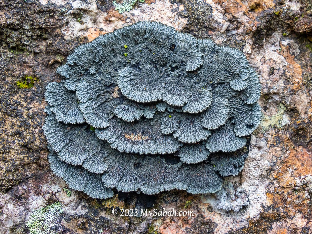
No rope support, stairway and hand rail are available for the first 6 kilometres. Some steep sections in the last 1-km descend have rope support. You would want to wear gloves for roping. Anti-leech socks are not necessary unless you can’t tolerate leech bite at all. According to the guides, for every 20 people, there might be only one or two of them might get leech bite, as leech (pacat) is not common there.
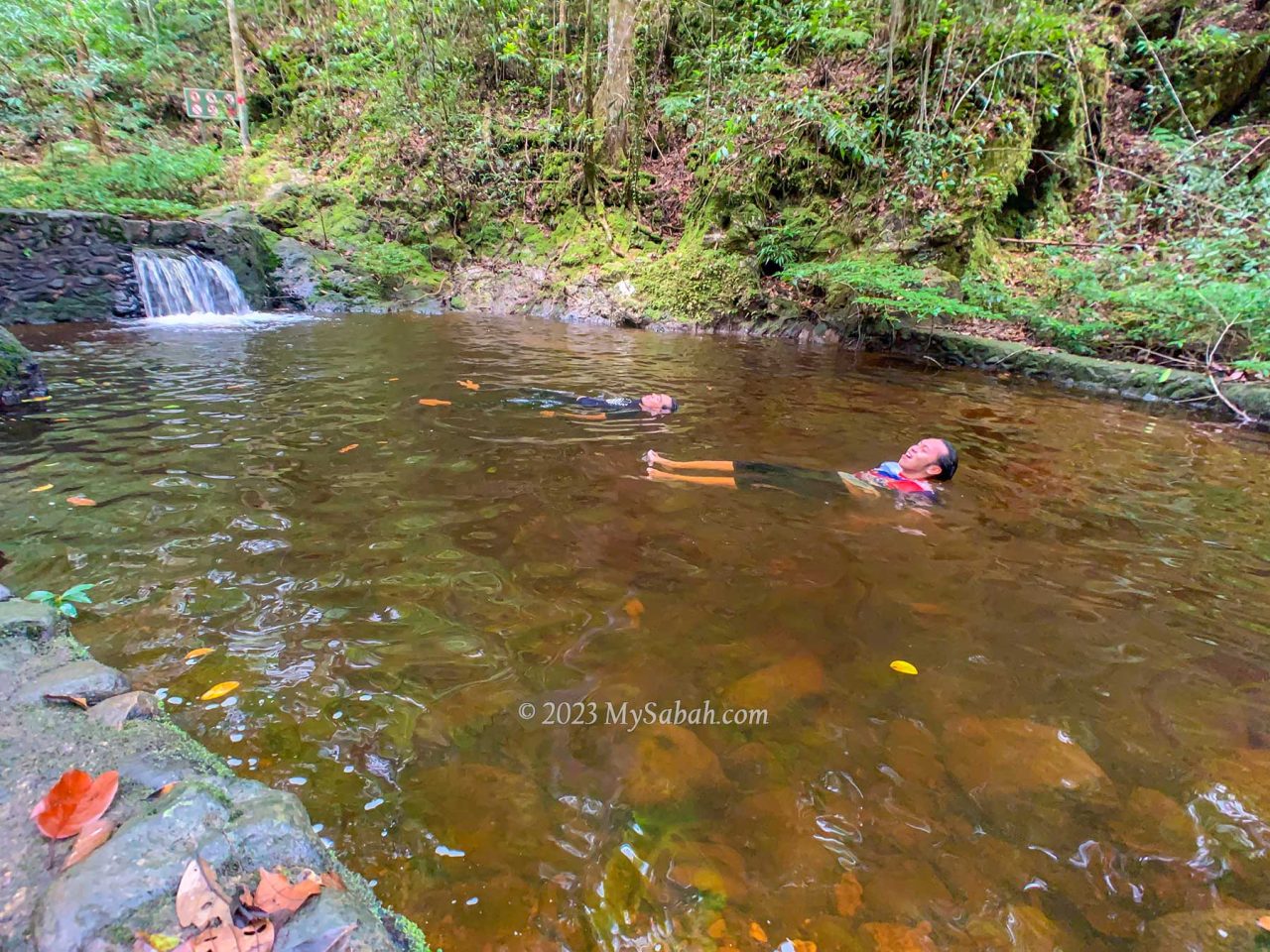
The forest of Wullersdorf is warm and humid, wearing T-shirt and hiking pants is good enough (preferably quick dry). Drinking water is the most important. I finished 1.2 Litre of water. The summit has limited shade to protect you from afternoon sunlight, apply sunscreen if required.
Things to Bring
- Backpack
- Raincoat or poncho
- Water (at least 1 Litre)
- Energy bar or snacks
- Packed lunch
- Toilet paper
- Camera
Optional
- Gloves
- Sunscreen lotion / spray
- Foldable hiking stick
- Anti-leech socks
- Insect repellent
- Towel and spare clothing (for swimming or changing after hike)
- Personal medicine
How to Book
Only two agents are allowed to bring tourists to Wullersdorf Peak. You can contact one of them below.
1) Biro Pelancongan Koperasi
Phone (Whatsapp): +60 11-35485773, +60 10-9540209 (Pakri and Eady)
Facebook: Wullersdorf Peak
2) Uncle Mul
Phone (Whatsapp): +60 19-8233896
I booked with Biro Pelancongan Koperasi. The fee is RM35 per person but requires a booking of minimum 10 people (or you can pay more). The fee includes permit (to enter forest reserve), vehicle transfer, guide, and certificate. The gathering point is in Kampung Balung Cocos (see Location Map), a village about 14 km from Tawau airport.
References
- “Geological heritage features of Tawau volcanic sequence, Sabah.” Sanudin Tahir, Baba Musta & Ismail Abd Rahim. Bulletin of the Geological Society of Malaysia 56 (2010) 79 – 85
- Annual Report 2022 by Sabah Forestry Department
- Ulu Kalumpang-Wullersdorf Sustainable Forest Management (SFM) Project
- Proposed gold mining in Balung Participate in review of draft TOR, folks urged, Daily Express, 13 Feb 2015
Photos taken in Tawau, Sabah, Malaysia Borneo
