Mount Kinabalu is the sacred mountain of Sabah’s indigenous people. During the active volcanic period from the Early Miocene to the Pleistocene in the eastern part of Sabah, did the people from that era worship these volcanoes? Currently, all volcanoes in Sabah are extinct, and many people are unaware that Tawau has at least 10 volcanoes that became extinct approximately 12,000 years ago. Anyway, a dead volcano is still a volcano. Climbing to the summit of a volcano fulfills my interests in its geological, spiritual, and ecological features.
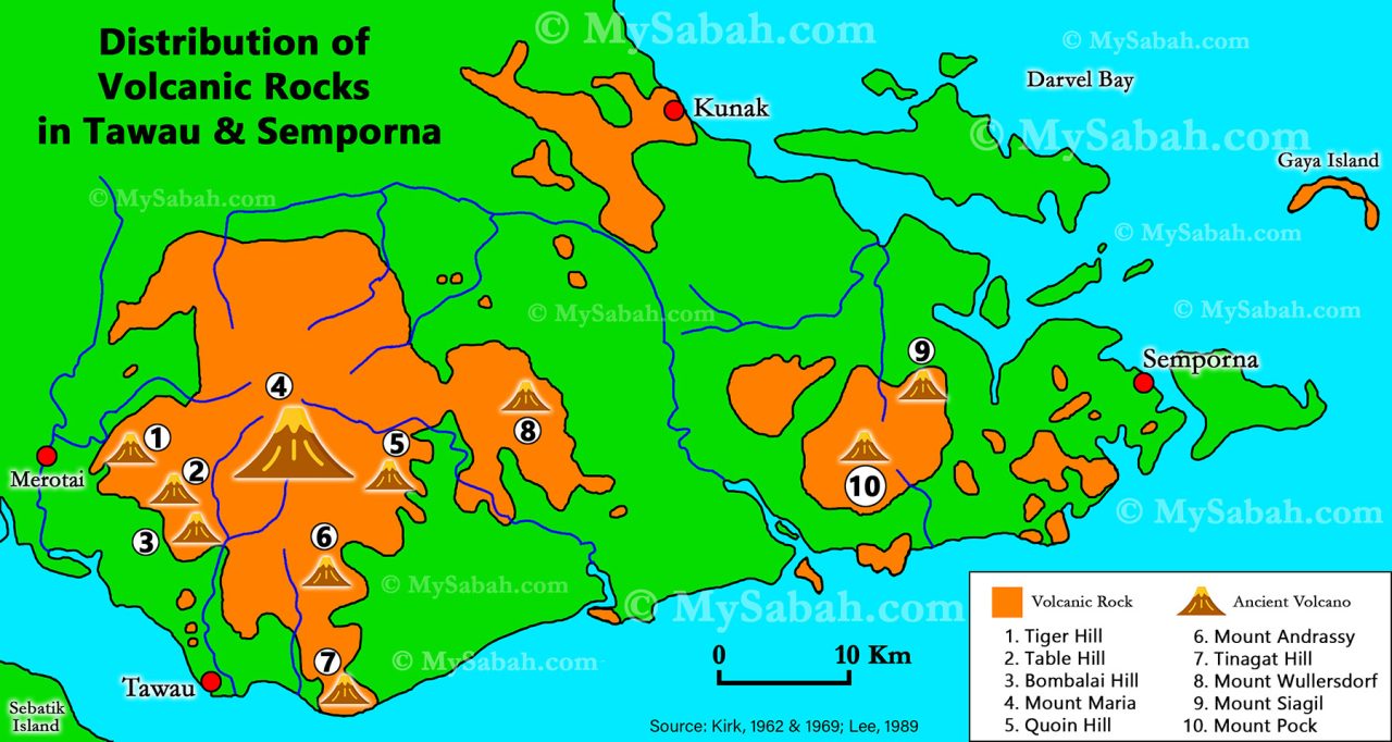
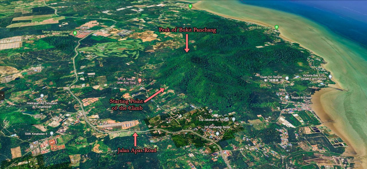
Bukit Panchang (or Panchang Hill, where ‘Bukit’ means ‘Hill’) is the fifth Sabah volcano I’ve climbed, following Bombalai Hill, Mount Wullersdorf, Bukit Tengkorak and Bohey Dulang. Situated in the Tinagat Forest Reserve, Bukit Panchang or Bukit Panchang Tinagat is less than 10 kilometers away from Tawau town.
About Tinagat Forest Reserve
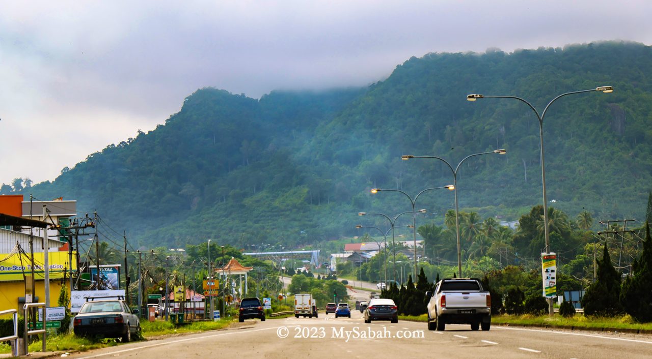
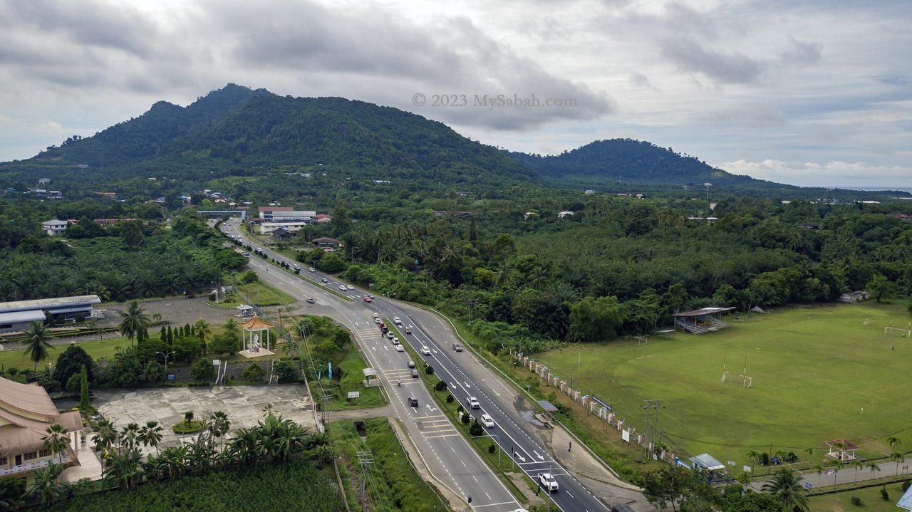
Managed by the Sabah Forestry Department, Tinagat Forest Reserve is classified as a Class-1 (fully protected) forest reserve, covering an area of 1,011 hectares (or 10.11 square kilometers). Traveling along Jalan Apas, one of Tawau’s main roads, in the morning, you’ll witness this lush hilly forest veiled in mist. Amidst the extensive conversion of land around Tawau into oil palm plantations, Tinagat Forest Reserve stands as one of the few remaining forested areas near the town.
Tinagat essentially represents a multi-peaked ancient volcano blanketed by dense forest cover. Remarkably, numerous climbing trails lead to various peaks on this hill. Among them, Bukit Panchang claims the highest altitude at 398 meters (1,306 feet). Bukit Panchang is probably a new official name, as many locals used to call it Bukit Kinabutan or Bukit Tinagat. Other notable peaks within the Tinagat Forest Reserve include Bukit 38, Bukit Akar, Hero Hill (Batu Payung), Bukit Kayawan, and Bukit Kiawan.
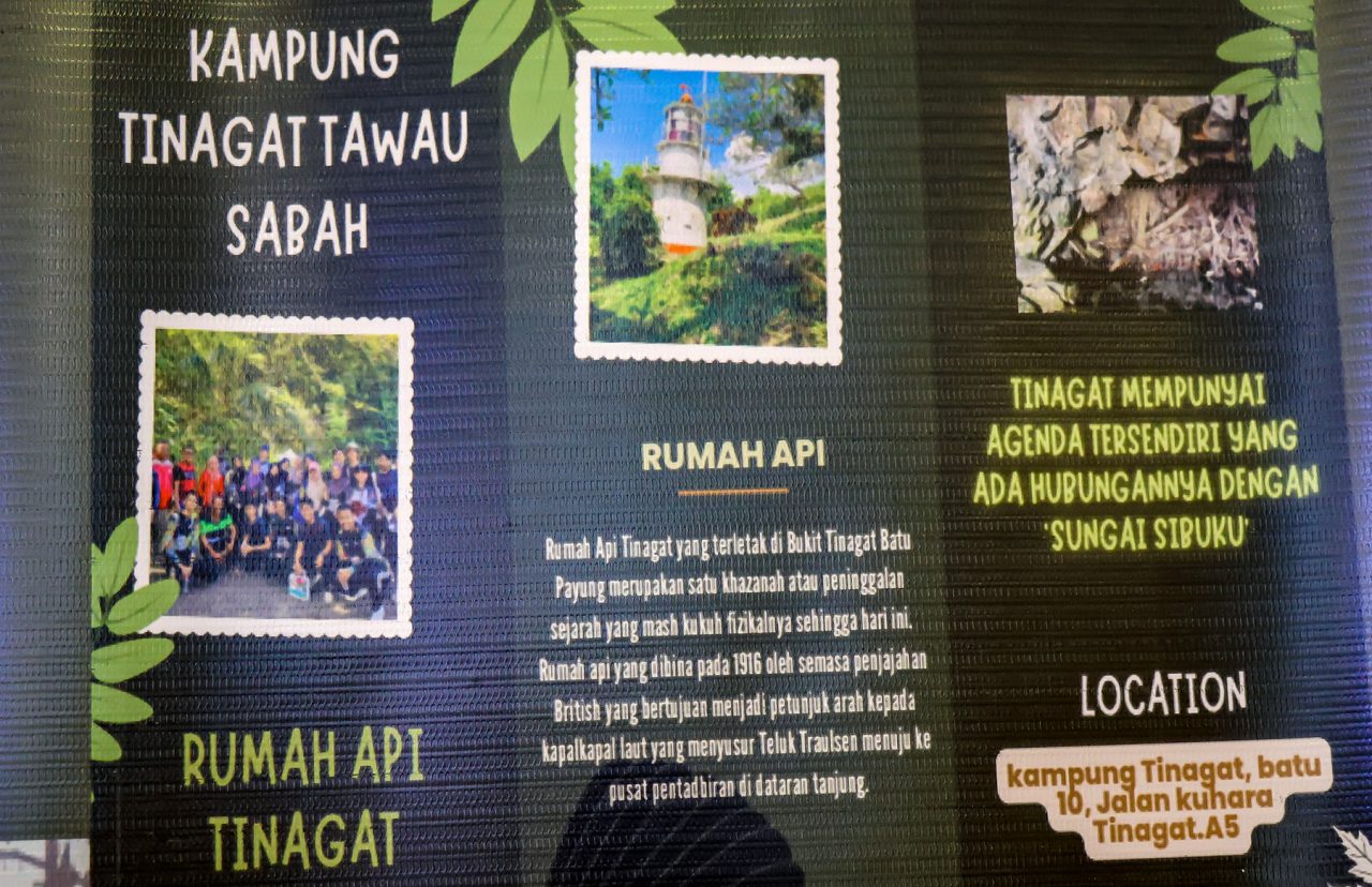
A century-old lighthouse (Rumah Api Batu Tinagat), constructed by the British colonial government in 1916, stands at the foothills facing the sea. This 9-meter-high Batu Tinagat Lighthouse is currently a restricted area. However, PELKO (Pelancongan Komuniti Tawau, associated with Politeknik Tawau) suggests that it will soon be accessible to tourists. On 23rd February 2018, Batu Tinagat Lighthouse was among the 24 heritage sites in the state officially designated by Sabah’s State Heritage Council under the new enactment of the ‘State Heritage Enactment 2017’.
Not far from the Batu Tinagat Lighthouse lies Batu Payung (literally meaning Umbrella Rock), which is tied to a legend that lends Tinagat its name (Tinagat translates to ‘Cut Down’ in the Tidung language). According to the tale, long ago, a young farmer encountered seven heavenly princesses bathing along the beach. Captivated by their beauty, he devised a plan to win one of them over by stealing her clothes. Unable to locate her dress, the youngest princess was stranded on Earth. Eventually, she married the young man and bore him a child.
One day, during a festival, the princess was invited to perform a dance. As she danced in her old attire, hidden from her until then, her body began to levitate and ascended to the top of Batu Payung. In a desperate attempt to get her back, her husband cut down the rock, but she continued to soar away. All that remained was a message she left behind: ‘Please take care of our child. If he cries, bring him to Sungai Sibuku (Sibuku River).’
Climbing Bukit Panchang
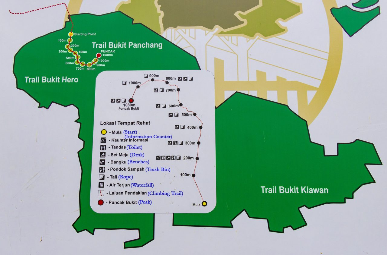
Bukit Panchang is steep but not too difficult to climb. The trail to the peak spans about 1,080 metres one way, typically taking around an hour to complete. Your climb will start with a steep slope, sorry, no warm-up for you.
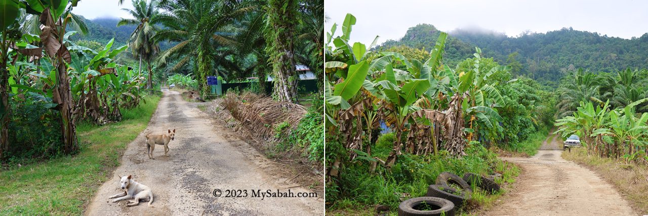
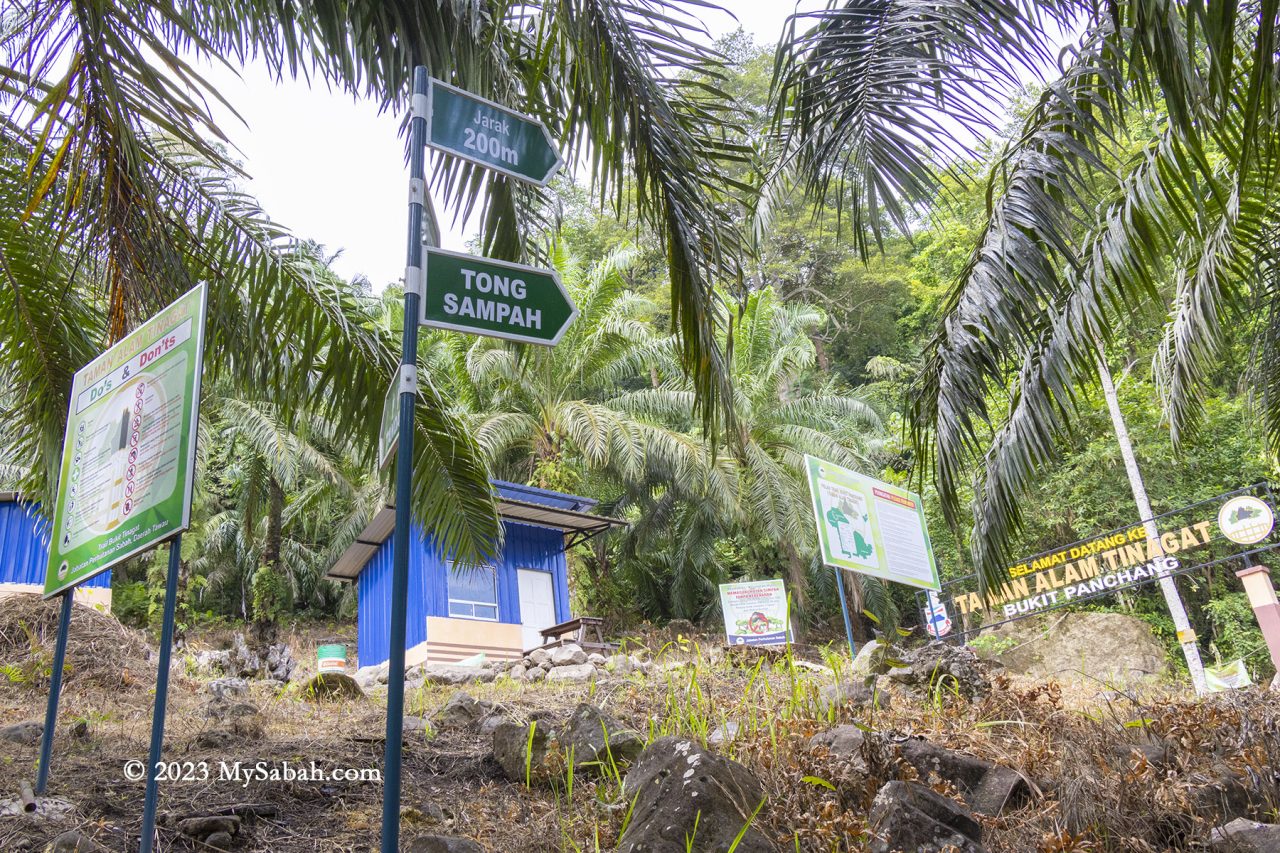
Initially, a 200-metre walk on a gravel road within an oil palm plantation leads to the Sabah Forestry station (or checkpoint) at the foothill. Here, they’ve established amenities like toilets and gazebos. Beware of village dogs, though I found them quite friendly.
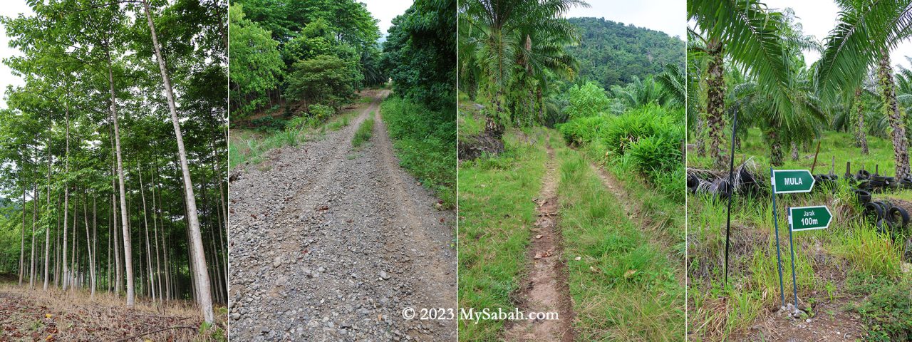
Thanks to the dense forest, the trail offers ample shade. Approximately 90% of the time is spent ascending, with mild to steep slopes. Tawau hikers often describe climbing steep hill as ‘feeling like Panchang,’ signifying its steepness.
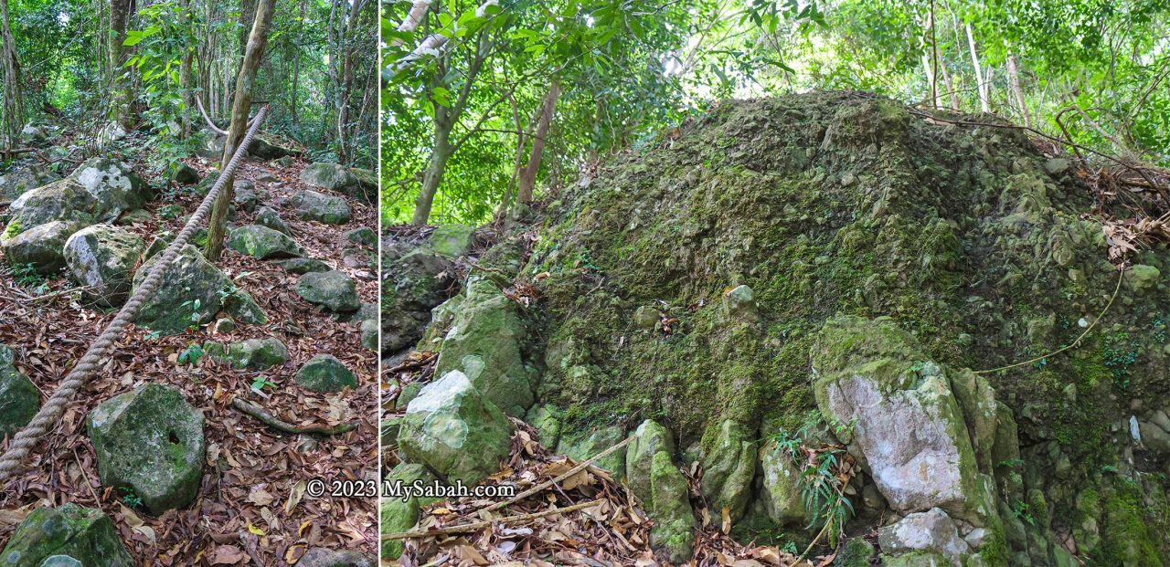
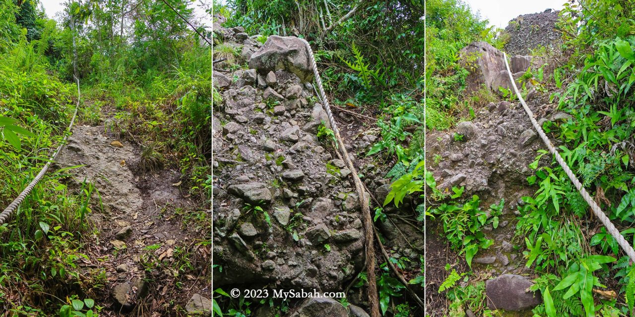
The most challenging segment involves a 200-metre-long steep boulder section at the trail’s onset. After rainfall, this section transforms into a waterfall, so I strongly advise against attempting the climb during the wet season.
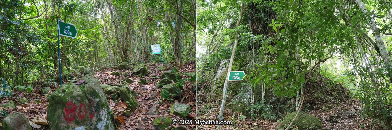
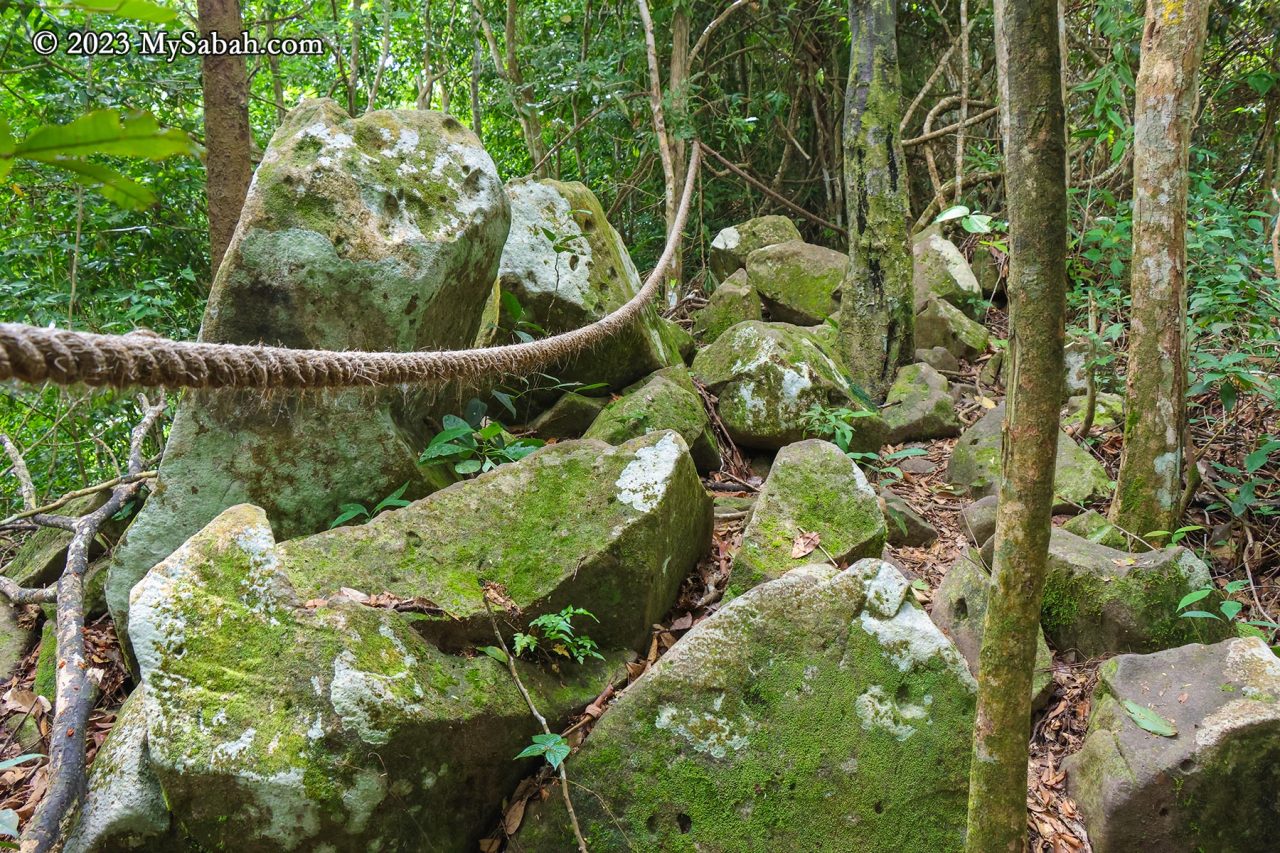
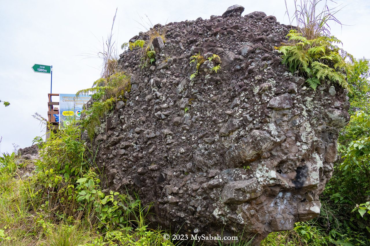
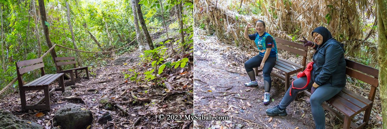
Throughout the climb, numerous exposed volcanic rocks and rockfaces remain visible, indicating Bukit Panchang was used to be a rocky hill. Rope supports are placed along the trail, providing climbing aid. The ropes also serve as guides leading to the summit. Distance markers every 100 meters serve as motivational checkpoints, and some spots have benches for resting. Fortunately, there are no leeches.
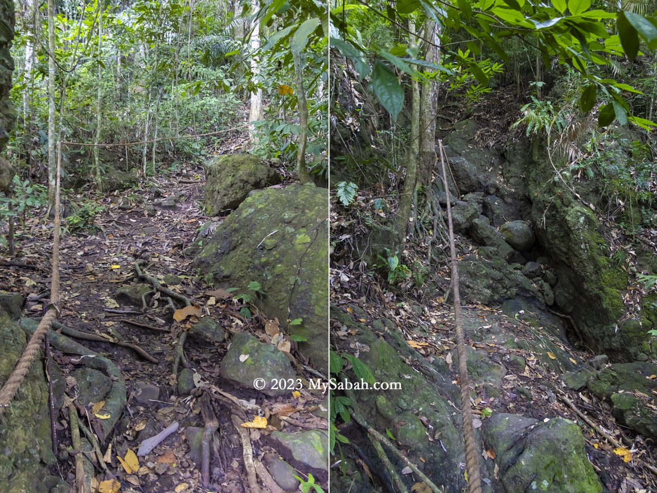
In 2021, four kindergarten teachers lost their way in the Tinagat forest, but were thankfully rescued the following day. As a safety precaution, the Sabah Forestry Department now requires hikers to enlist a ranger’s guidance. Personally, I believe the hike isn’t dangerous if one exercises caution.
The Vegetations
After volcanic activity stopped thousands of years ago, this hill is covered with trees and plants that thrived in its fertile volcanic soil. While many perceive trees as mere providers of oxygen, the reality is that a rainforest hosts a multitude of plants offering food, medicinal properties, timber, firewood, and more.
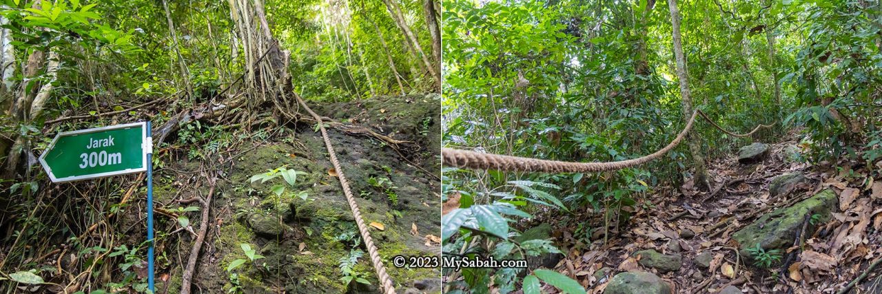
The forest covering the Tinagat hills primarily consists of mixed dipterocarp forest, a typical rainforest found in the hills of Borneo. However, the trees here tend to be relatively smaller, possibly due to the thin layer of soil.

Along the trail to the peak, 30 or more trees are labeled with their scientific and local names. Providing additional information on these labels would greatly benefit non-botanist visitors, who want to learn more about the diverse flora present. I list a few trees that are interesting and useful.
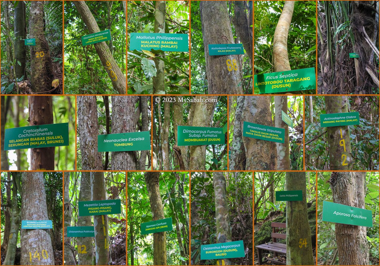
- Arenga undulatifolia (Polod) is a tree that can feed and kill. Its fruits are poisonous but the apical bud (known as a ‘palm heart’) is edible. The petioles and midribs are used to make darts for blowpipes.
- Cratoxylum cochinchinensis, known as Selangan Biabas (Suluk) or Serungan (Malay, Brunei) is probably the most useful tree. Its timber, traded under the name ‘derum,’ is prized for medium to heavy construction. Additionally, its young fruit and shoots are edible, while the young leaves serve as a tea substitute. Its roots, bark, and twigs can treat colds and diarrhea.
- Celtis philippensis offers a versatile range of applications: the seed oil finds use in producing lubricants and soap. Its bark supplies valuable fibers utilized in crafting ropes and paper. Furthermore, the wood is used in making poles, tool handles, beams, joists, rafters, cheap furniture, box lumber, and as fuel.
During World War II, villagers relied on their resourcefulness and the abundance of the forest. Many could retreat deep into the jungle, hiding for months as they relied on the forest for sustenance and survival.
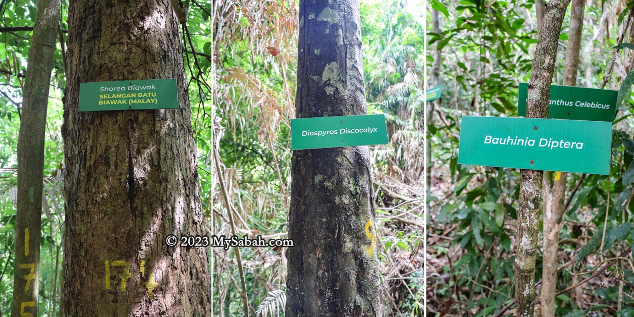
There are five or more trees endemic to Borneo on this hill.
- Shorea biawak, known as Selangan Batu Biawak in Malay, is assessed as Endangered. It yields quality wood used in handicrafts.
- Diospyros discocalyx, deriving its specific epithet from the Latin for ‘disc-shaped calyx,’ thrives in lowland mixed dipterocarp forests
- Bauhinia diptera is a climbing shrub primarily found in the wet tropical biome.
- Chionanthus pubicalyx is endemic specifically to Borneo.
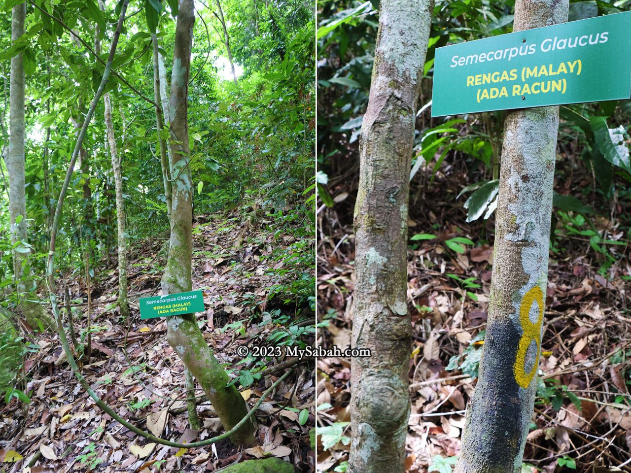
For hikers, they need to be cautious to a tree called Semecarpus glaucus (locally referred to as Rengas in Malay). Avoid touching this tree or its sap, as it can lead to severe skin irritations such as rashes and itching.
Reaching the Peak
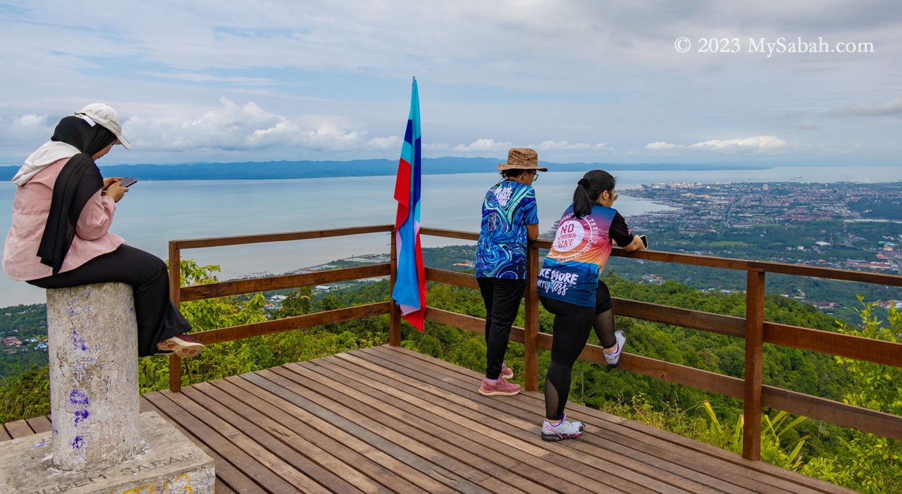
As I approached the peak, the trail’s inclination gradually eased, transitioning into a gentle ridge walk leading to the summit of Bukit Panchang. Hikers who had reached earlier cheered to show encouragement. Among them were Suzan and Priscilla, local regulars who’ve conquered most of Tawau’s hills and mountains.
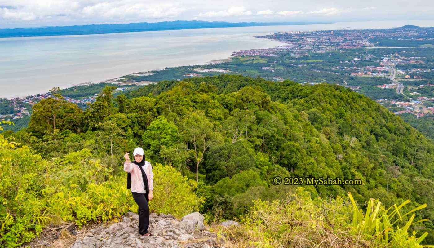
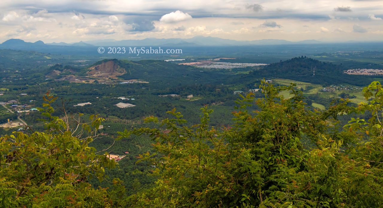
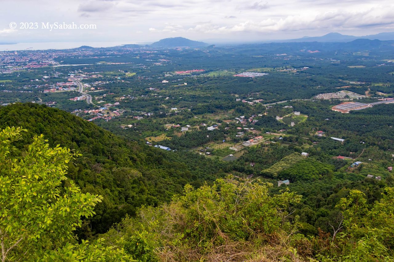
At the peak, a raised wooden platform awaited, inviting a well-deserved rest and the chance to savor the victorious moment from an elevated vantage point. Not gonna lie, the 270 degree panoramic view on the peak is breathtaking. To the left lies the Celebes Sea, while to the right unfolds Tawau town and its surrounding plain. Notably, the sight extends to Pulau Sebatik, an island situated 13 kilometers away, shared nearly evenly between Malaysia and Indonesia.
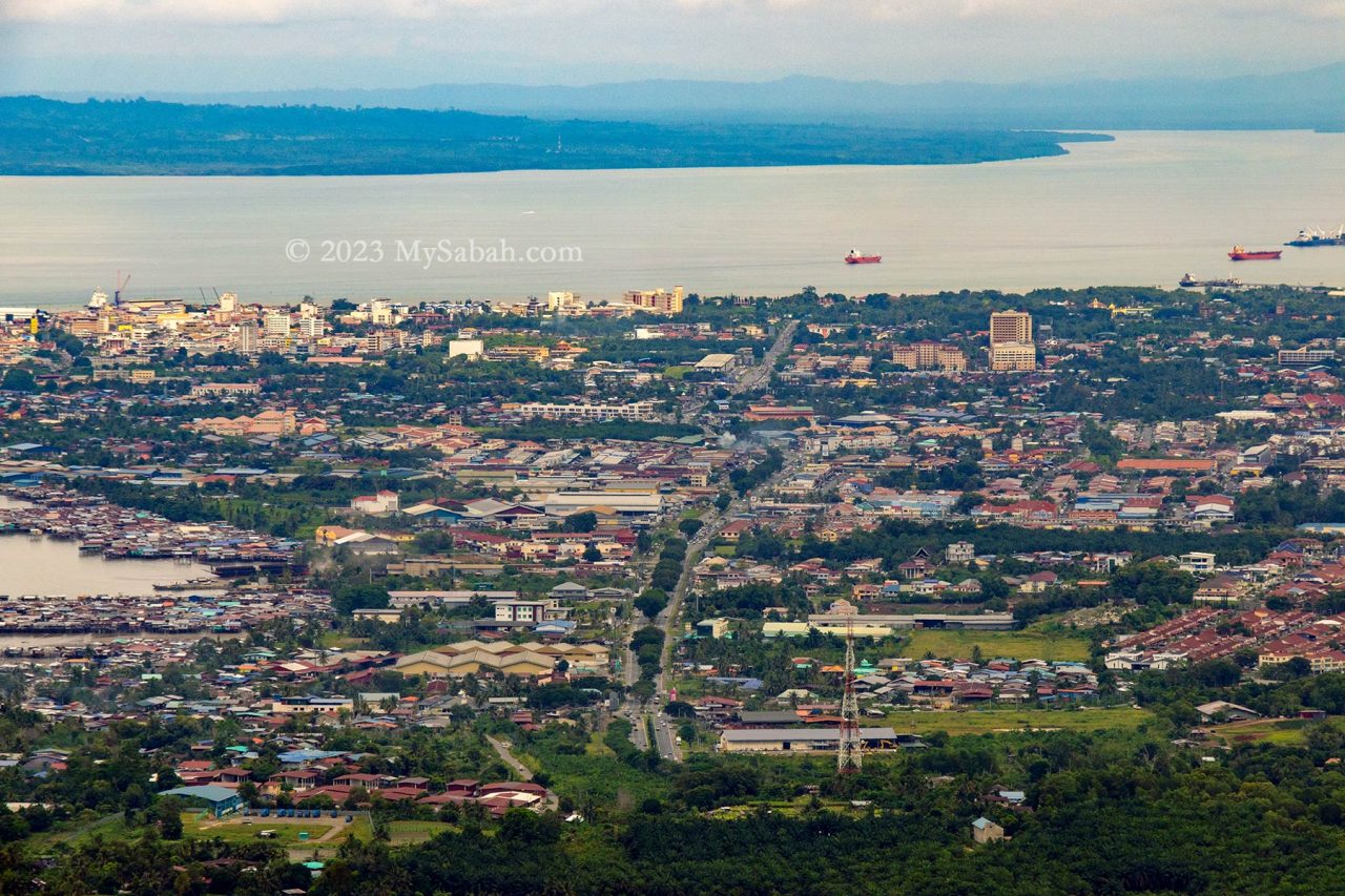
Despite being only 9 kilometers away, Tawau town remains clearly visible even during hazy days. Beyond this bustling coastal town sprawls an extensive area dominated by oil palm plantations, residential areas, and notable landmarks like the Shan-Shui Golf & Country Club.
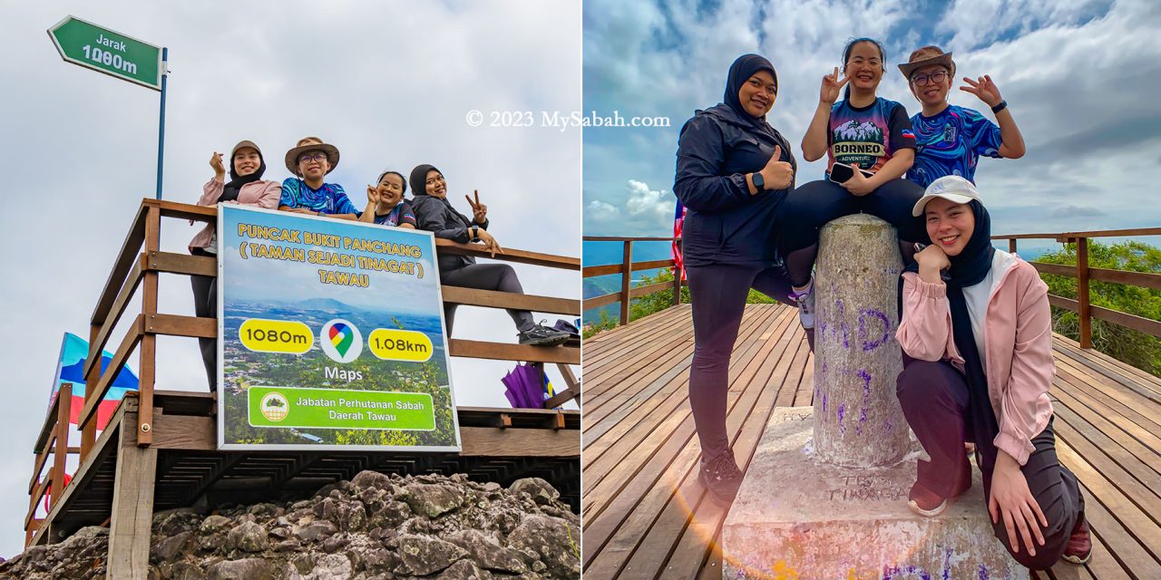
At 398 meters (1,306 feet) above ground level, the peak of Bukit Panchang offers a higher vantage point compared to both the KL Tower and the Eiffel Tower.
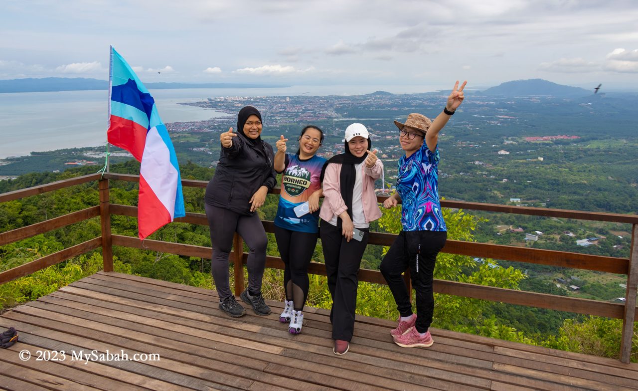
Nestled within this plain are a handful of isolated forested hills, awkwardly encircled by expanses of oil palm. These remaining green hills—Bukit Gemok, Tiger Hill, and Membalua Forest Reserve—stand as vestiges of a volcanic past. I earnestly hope that the people of Tawau will endeavor to protect these fragmented forests, preserving their essence as remnants of past volcanic activity.
How to get there
To embark on the Bukit Panchang ascent, navigate towards Tawau town’s Jalan Apas road until reaching Mile 6.5 (Batu 6.5). Look for the junction marked by a white cement signage adorned with prominent red lettering that reads ‘Selamat Datang Ke Kau Sing (高昇)’—translated as ‘Welcome to Kau Sing.’ Turn into this junction to proceed onto a narrow and straight road.

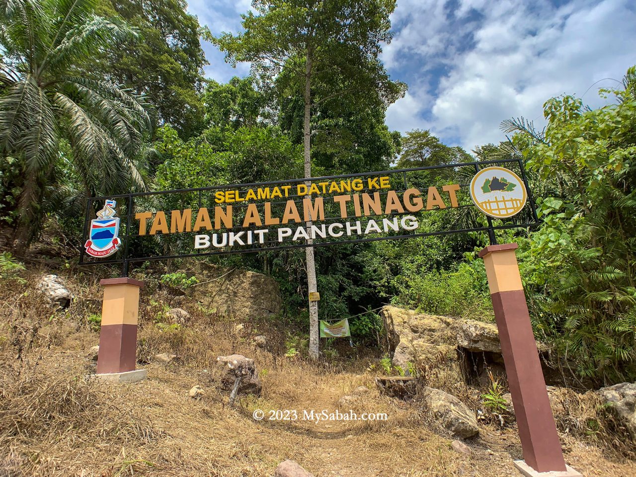
As you drive, maintain a slow pace and keep an eye out on the right-hand side for a small junction labeled No. 10. Adjacent to it (see Location Map), there’s a coloured signboard displaying ‘Taman Alam Tinagat’ (means Tinagat Nature Park). Park your car safely along the roadside, then proceed by foot towards the junction featuring a gravel path that leads directly to the foothill (forest station).
Upon entry at the Sabah Forestry station, visitors are required to pay an entry fee of RM5 for Malaysians and RM15 for foreigners. Additionally, hiring a guide is mandatory at RM50, and one guide can accompany up to five climbers. For optimal savings, a team of five climbers can share the cost of one guide. Even solo climbers must pay the full RM50 fee for a guide.
Unauthorized entry is considered illegal encroachment and can result in severe penalties. Offenders could face fines up to RM50,000, imprisonment for up to 3 years, or both.
Tinagat was once a popular hiking destination among locals. However, the number of regular visitors has significantly declined due to the added guide fee. While Bombalai Hill could be a viable alternative, its distance from Tawau town makes it less accessible for many.
You can contact Sabah Forestry Department of Tawau district via the following channels for more information:
Facebook: Destinasi Rekreasi Hutan Simpan Perhutanan Daerah Tawau
Phone: +60 89-761833
E-mail: trhsm2021@gmail.com
Things to Bring
Besides wearing a pair of comfortable hiking shoes, you should bring the following items:
- Cash
- MyKad or identity card
- Drinking water (1 Litre)
- Raincoat / Poncho
- Insect repellent
- Sunscreen lotion
- Snack or energy bars
- Hiking stick (Trekking pole)
Photos taken in Tawau, Sabah, Malaysia Borneo
